






Experience the mossy forests of Shiratani and the dizzying view from Taiko iwa on your way to the mysterious tree called Jomon Sugi, the largest tree on the island. Because of the time required for this hike, I only recommend this route if you are SERIOUSLY FIT and active.
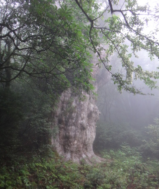 Jomon Sugi, est. age of 2,170~7,200
years.
Jomon Sugi, est. age of 2,170~7,200
years.
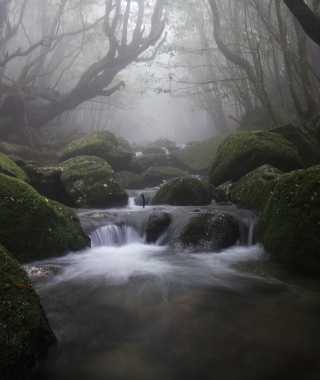 Cross streams that form Shiratani's moody
ravine.
Cross streams that form Shiratani's moody
ravine.
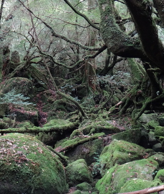 Pass by the Moss Forest made famous
by the movie, Princess Mononoke.
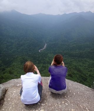 Enjoy the view from
Taiko Iwa.
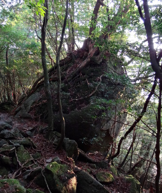 Leave the park and down past large
boulders to the valley.
Leave the park and down past large
boulders to the valley.
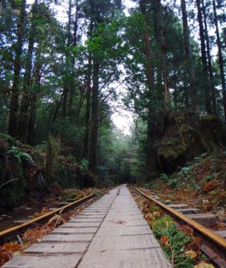 Spend an hour walking along the former
logging rail way.
Spend an hour walking along the former
logging rail way.
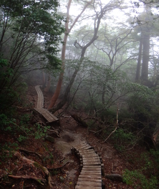 Leave level ground again for the last 2.5
km to Jomon Sugi.
Leave level ground again for the last 2.5
km to Jomon Sugi.
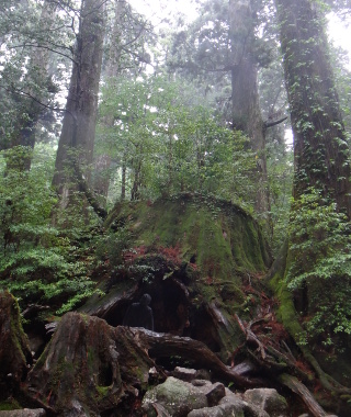 Stop by Wilson's Stump, a tree cut down
around the age of 3,000 years.
Stop by Wilson's Stump, a tree cut down
around the age of 3,000 years.
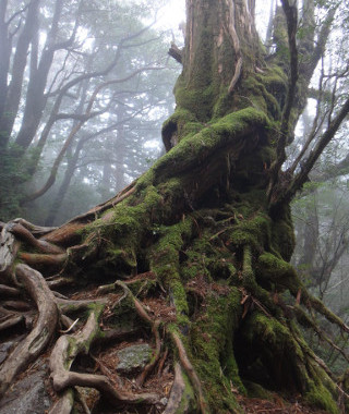 The forest becomes increasingly mystical
as you approach Jomon Sug.
The forest becomes increasingly mystical
as you approach Jomon Sug.
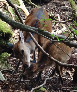 Make new friends along the way?
Links:
- Official Shiratani Unsuikyo Park Website
- Certified Guide List
- Town Page
- Hiking Notification
- Brochure and Island Map
- Trail Times, Bus Schedule
Content last updated in 2020.
- Experience Level:
- Advanced
-time requirement - Trail Head Access:
- Car or Taxi
- Time:
- 10~12 Hours, assuming a fast pace
- Round Trip Distance:
- 21 km
- Trail Head Elevation:
- 600 m
- Peak Elevation:
- 1285 m
| Deer/Monkey Sightings | ☆☆☆☆☆ |
| Yakusugi Trees | ☆☆☆☆☆ |
| Mossy Forests | ☆☆☆☆☆ |
| Vista Views | ☆☆☆☆☆ |
| Endurance | ⚠⚠⚠⚠⚠ |
| Strength & Technicality | ⚠⚠⚠⚠⚠ |
| Crowds | ⚠⚠⚠⚠⚠ |
| Weather Cancellations | ⚠⚠⚠⚠⚠(Extreme rains, flooding, rarely snow) |
- Costs:
-
The town of Yakushima recommends a voluntary donation of ¥1000
(valid for all World-Hertiage Site day hikes in one month) A taxi from Miyanoura costs around ¥2500 each way.
For a guided hike, I used to charge ¥15,000~¥20,000 per hiker, but most guides do not offer this route. - Getting to the Trailhead (GPS coords: 30.3809, 130.5751):
- The closest town is Miyanoura.You can either take a taxi or a car, but plan to leave the trail head no later than 6 am, earlier if you have not eaten breakfast yet.
- Toilets:
- There toilets at the Shiratani Unsuikyo Park parking lot, Shiratani Unsuikyo Hut, just beyond the junction with the train tracks, and at the end of the train tracks. All other waste and toilet paper, including wag bags, must be carried out. There booths between the end of the train tracks and Jomon Sugi for use with a toilet kit (wag bag) if you bring one.
- Equipment List:
- Water Bottle, Breakfast + Lunch + Snacks, Headlamp + Batteries, Map + Compass, First Aid Kit, Rain Jacket + Rain Pants, Hiking Shoes, Spare Jacket, Disposable Toilet Kit, etc.
- The Hike:
- The hike begins in beautiful Shiratani Unsuikyo. By all means, take the direct route towards Taiko Iwa.
Chances are, it will be too dark to see much until you reach Shiratani Unsuikyo Hut (a freely usable emergency shelter).
A few minutes after the hut is the famous Moss Forest (signage in Japanese, 2020), and from here, the climb up towards the
saddle point called Tsuji Toge begins. From Tsuji Toge, the lookout of Taiko Iwa is a half-hour side trip, but plan to spend longer
since the view is gorgeous. You'll pass by Tsuji Toge again on the way back, of course, but, unless you're really behind on time, or the weather is foggy, I like to hike up to Taiko Iwa in the morning for the most famous
view of the island. Looking out across KosugiDani Valley, which was heavily logged until 1970, towards the central peaks, the world
feels a bit like a fish bowl. You should leave Taiko Iwa well before 8am unless everyone in your group is a trail runner.
After returning to Tsuji Toge, turn left and head downhill about 40 minutes to the train tracks. Turn right and head up the train tracks for about an hour. Stop at the toilets at the end of the train tracks before heading up the Ōkabu Trail (literally, Big Stump Trail). From here on, there are a lot of narrow stair cases, and almost everywhere else is rocky, so try to be patient with large groups; their leaders should let you pass as soon as they are at a safe space to stop. About a half-hour into the Ōkabu trail, you should arrive at Wilson Stump. Go inside, pay your respects to the tree spirit, and photograph the "heart." There may be a que. Upon departing Wilson's Stump, skip the "nature observatio trail" unless you're all train runners. Until shortly before the observation deck there are occasional spaces to sit and each lunch on the boardwalk without blocking the trail or hurting the trail-side plants. The observation deck is pretty busy from around 11:15 until 12:45, but if you can often avoid much of the crowd simply by choosing to eat your lunch before or after you see Jomon Sugi. You may not eat lunch on the observation deck.
The observation deck itself is quite large, and although it does not wrap all the way around Jomon Sugi, you can get several very different perspectives.
Be aware that on your way back, you will still need to hik up from the train tracks to Tsuji Toge and back down to Shiratani Unsuikyo, so watch your time.
- Hybrid Option:
- If you plan right (and watch your time!) it is very possible to take a taxi and hike up through Shiratani Unsuikyo Park in the morning, (Again, leave the trail head BEFORE 6am), hike up to Jomon Sugi, and then hike down and out the train tracks to the Arakawa Trail Head. From the turnoff to Shiratani Unsuikyo to the Arakawa Trail Head is about an hour at a brisk walk. If you plan to do this, I highly suggest buying your shuttle bus ticket in advance (See notes for getting to the trail head in the classic Jomon Sugi hike.) and going over the shuttle bus and connecting bus times at an information booth. If, for some reason, you can't make it back in time to catch the bus, during tourist season, there is an attendent at the trail head until 8pm, and depending on your carrier, there is mobile phone service at the trail head. If you do not have a mobile phone, you will have to walk 4km up the road to reach a pay phone.
- In the case of bad weather
- If you can't cross the river shortly below the Shiratani Unsuikyo Hut, you either wait at the hut until the water recedes, or
you can try to hike out the train tracks to the Arakawa Trail Head. Once you pass Tsuji Toge, the Arakawa Trail Head is almost
always the safest route out of the moutains. There have been rare occasions when hikers have had to wait until the next day and walk down, and
people have drowned trying to hike out through Shiratani Unsuikyo, so you should always bring full rain gear
just in case you have to spend the night. There are water and emergency rations at the Arakawa Trail Head (2020). There is wifi (2020) at the
entrance to Shiratani Unsuikyo Park. Depending on your carrier, there is
cell phone service at the Arakawa Trail Head, atop Taiko Iwa, between DaiŌ Sugi and the entrance to the World Natural Heritage Site, and on the Jōmon Sugi observation deck.
About a ten minute hike beyond Jomon Sugi is Takatsuka Hut, which is an emergency shelter. Because of the high volume of hikers, rescue missions (by train, foot, or helicopter) in this area are not uncommon, but may be delayed by inclimate weather.